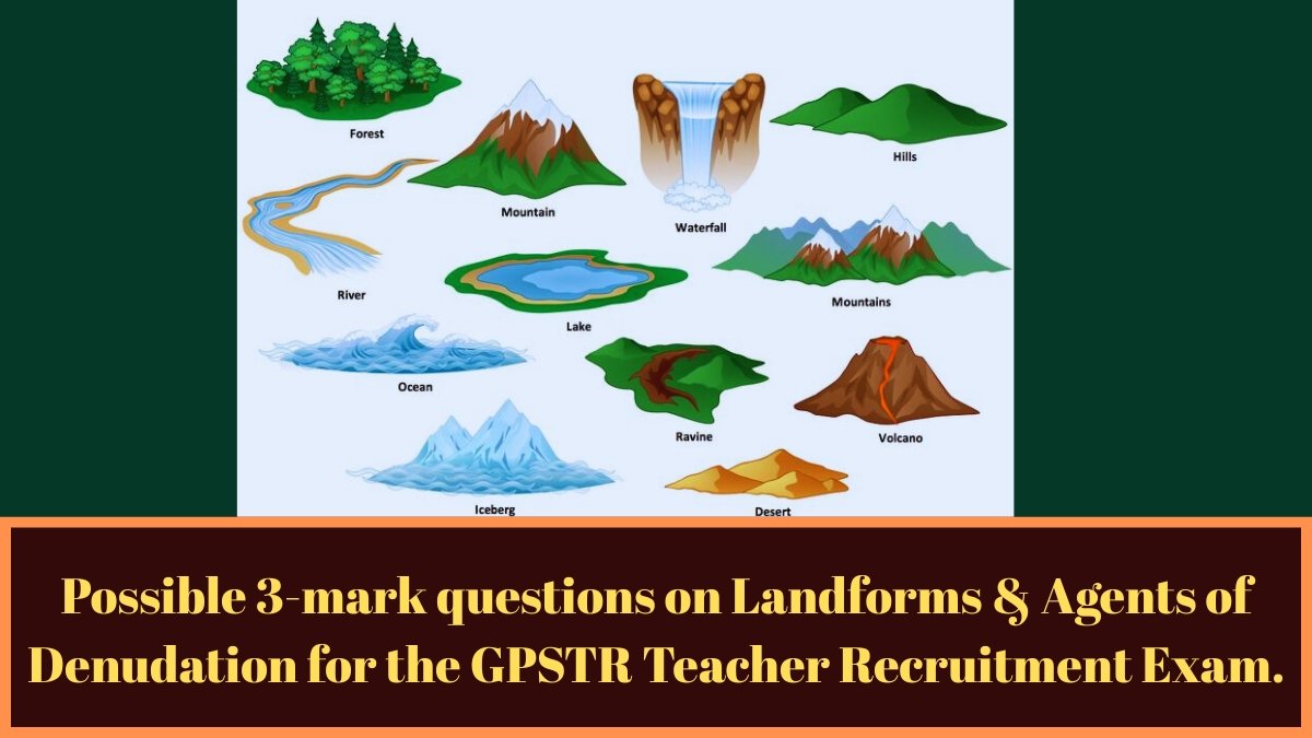
Landforms & Agents of Denudation: Possible 3-mark questions on Landforms & Agents of Denudation for the GPSTR Teacher Recruitment Exam.
1. The natural gaps across the mountains which provide routes are called
1) Peaks
2) Dunes
3) Plateaus
4) Passes
Ans:-4) Passes
• A mountain pass is a path through a mountain range or over a mountain.
• Some of the important mountain passes in India are: Joji La, Bara-Lachala Pass, Mana Pass, Shishya La, Jelep La.
————————————————————————-
2. Mounds of sand formed by wind action are called
1) Cliffs
2) Circuses
3) Dunes
4) Hamadas
Ans:- 3) Dunes
• A dune is a sand dune formed by the wind, usually on a beach or desert. Dunes form when the wind blows sand into a sheltered area behind an obstacle. Dunes grow as sand particles accumulate. Each dune has a windward side and a leeward side.
————————————————————————–
3. Breaking down of rock in situ is known as
1) Erosion
2) Weathering
3) Mass wasting
4) Degradation
Ans:- 2) Weathering
• The process by which rocks break down, disintegrate, and deteriorate is called “weathering”.
• Temperature, pressure, rain, snow, wind, plants, animals, and humans are the main factors responsible for erosion.
• Types of Decay:- There are three types of decay process.
1) Physical decay,
2) Chemical weathering and
3) Biological decomposition
————————————————————————-
4. Lake formed in a cut off river, meander is called:
1) Playa Lake
2) Meteoric Lake
3) Ox-Bow Lake
4) Crater Lake
Ans:- 3) Ox-Bow Lake
• Lagoons:- Lagoons and, as a result, meanders are formed due to simultaneous accumulation and erosion in a river valley.
• When a river flows through a very short path, it takes a straight path through the winding areas and does not advance, creating crescent-shaped lakes. These are called “peak lakes”.
———————————————————————
5. The formation of ‘Mushroom rock’ in desert region is an example of
1) Deflation
2) Attrition
3) Abrasion
4) Erosion.
Ans:- 3) Abrasion
• Other rocks are formed by the continuous action of wind erosion.
• The Mattom Rock, also known as Rock Pedestal or Pedestal Rock, is a naturally occurring rock whose shape, as its name suggests, resembles a mushroom.
• In desert areas, wind is a dominant force, and 95% of mushroom rocks are found in this region.
• Erosion is erosion by wind, in which transported materials strike the exposed rock surface and wear it away.
————————————————————————–
6. The mountain formed on the earth crust due to tension called
1) Young folded mountain
2) Old folded mountain
3) Laccolith mountain
4) Block mountain
Ans:- 4) Block mountain
• Due to instability caused by expansion or contraction of the earth’s crust, rock layers break and become displaced due to faults.
• Mountains with steep slopes on one side are formed when a part of a fault moves down, is lifted up, or is pushed to the other side. These are called ‘fault-induced mountains’.
• These mountains have a gentle slope on one side and a steeper slope on the other. These are called block mountains.
————————————————————————-
7. Rift Valley is formed
1) between two anticlines
2) between two faults
3) erosion of synclinal basin
4) due to volcanic eruption
Ans:- 2) between two faults
• A rift valley is a linear depression between highlands or mountain ranges formed by geological faulting. That is, a rift valley is a low-lying area and is a landform formed by the movement or rifting of the Earth’s tectonic plates. E.g. The Narmada River flows in a rift valley formed between the Vindhya and Satpura ranges.
————————————————————————–
8. Nappe is a kind of
1) fluvial feature
2) folded structure
3) erosional plain
4) delta region
Ans:- 2) folded structure
• In geology, a tectonic plate or thrust sheet is a broad term for a section of rock that has been moved more than 2 km or 5 km from its original position by folding. They are formed when a mass of rock is forced or compressed.
—————————————————————————-
9. The area which is resistant to any massive structural transformation is called
1) rigid mass
2) ancient landmass
3) tectonic plate
4) shield
Ans:- 4) shield
• A shield is a large area of generally exposed Precambrian crystalline igneous and high-grade rocks that form stable areas.
• Alkaline lava is high in iron and magnesium and low in silicon. Since it contains fewer gases, the lava erupts quietly. It takes a long time to solidify. This allows the lava to flow easily over long distances on the ground. This creates shield-shaped landforms with moderate slopes. Example: Mauna Loa volcano on the island of Hawaii.
—————————————————————————
10. The area marked by internal drainage
1) Plateau
2) Plains
3) Deserts
4) Mountains
Ans:- 3) Deserts
• An internal drainage is a closed drainage basin that retains water and does not have outflows to other external water bodies such as rivers or oceans, instead draining into lakes or ponds.
• Drainage systems are usually found in deserts.
• For example:- The Luni River originates in the Pushkar Valley of the Aravalli Range in the northwestern part of India, passes through the Thar Desert, and ends in the Rann of Kutch in Gujarat.
————————————————————————–
Landforms & Agents of Denudation: Possible 3-mark questions on Landforms & Agents of Denudation for the GPSTR Teacher Recruitment Exam.
11. Which of the following refers to the white salt which covers the land in some areas during dry season?
1) use
2) reh
3) erg
4) reg
Ans:- 2) reh
• Rez refers to a mixture of dissolved sodium salts that is spread like a flower on the ground in arid or semi-arid regions of India.
• It covers the earth in the form of a white layer. It is also called Kallar.
—————————————————————————–
12. A landscape which is caused due to the fissure in the earth along which one side has moved down with reference to the other is known as
1) Rift Valley
2) U Shaped Valley
3) V Shaped Valley
4) Hanging Valley
Ans:- 1) Rift Valley
• A rift valley is a narrow, low-lying area formed by a rift in the earth. A rift valley is formed over different landmasses.
—————————————————————————-
13. Sink hole is a phenomenon of:
1) Plain
2) Desert
3) Tundra
4) Karst
Ans:- 4) Karst
• Karst topography
• A landform formed by the dissolution of rocks such as limestone, dolomite, and gypsum by the action of groundwater or surface water.
• A sinkhole is a depression in a limestone/dolomitic area.
• Sinkholes:- Depression on the limestone/dolomitic region. A great variation is seen in sizes of sinkholes with areas from a few sq. m to a hectare and with depth from a less than half a metre to thirty metres or more.
—————————————————————————-
14. A group of inter-connected islands is known as____________
1) Strait
2) Peninsula
3) Archipelago
4) Lagoon
Ans:- 3) Archipelago
• An archipelago is sometimes called an island group or island chain.
• Indonesia, Japan, the Philippines, New Zealand, the Maldives, the Bahamas, Greece, Hawaii, and the Azores are examples of well-known archipelagos.
• Intercontinental islands:- These were originally parts of major landmasses and have separated over time.
• Isolated islands:- Water areas close to the mainland, e.g. Mozambique, Sri Lanka, Greenland, etc.
• Archipelagos:- A group of several islands. Ex: Indonesia, Philippines
• Torana Islands:- These are found in a crescent shape, like a garland of flowers, from one part of the main landmass to the other.
• Example:- Elucius Island, Curell Island
—————————————————————————–
15. The term “Doab” means
1) a land between two mountains
2) a land between two lakes
3) a land between two rivers
4) a land between two seas
Ans:- 3) a land between two rivers
• Doab is the term used for the land between two rivers.
• Oxford Hindi defines it as a plain area between (e.g. between the Ganges and the Yamuna). In the English dictionary,
————————————————————————–
16. The land forms formed by wave erosion is:
1) Spit
2) Beach
3) Cave
4) Barrier island
Ans:- 3) Cave
• Cliffs, caves, arches, and piles are some of the landforms produced by wave erosion.
• Caves form in rock bands that run across the direction of the waves’ impact.
———————————————————————–
17. A broad, Iow embankment built up along the banks of a river channel during floods is called
1) Delta
2) Levee
3) Flood Plain
4) Dune
Ans:- 2) Levee
• Levees are wide, low-banked ditches, dikes, or flood barriers built along the banks of a river during floods.
• The banks are usually parallel to the direction of the river flow. Therefore, the embankments help to direct the flow of the river. Dams can be artificially created or reinforced.
—————————————————————————
18. Winds blowing constantly in one direction in rocky deserts form
1) Chimneys
2) Mushrooms rocks
3) Yardangs
4) Demoiselles
Ans:- 3) Yardangs
• In desert areas, wind erosion transforms bands of soft rocks into long, narrow ridges.
• The ridges that hang over the steep sides of the hard rocks, called yardangs, are distinguished. Instead of lying in horizontal layers on top of each other, the hard and soft rocks of yardangs are arranged in vertical bands, aligned in the direction of the blowing wind.
——————————————————————————
19. What is an isthmus?
1) A water body separating two land masses
2) A narrow strip of land separating two water bodies
3) Deep penetration of a water body in land
4) None of these
Ans:- 2) A narrow strip of land separating two water bodies
• A narrow strip of land connecting two larger land masses is called an isthmus.
• An isthmus connects two continents or joins a peninsula with the mainland.
• The Isthmus of Panama and the Isthmus of Suez are typical examples.
——————————————————————————
20. How did the Lakshadweep islands of group originate?
1) Volcanic origin
2) Soil Deposition
3) Coral origin
4) No option is correct.
Ans:- 3) Coral origin
• Lakshadweep is a group of coral islands in the Laccadive Sea.
• It is called a coral island because it is made of coral, which are the skeletons of tiny sea animals called polyps.
• When living polyps die, other polyps grow on their hard skeletal tonsils. They grow higher and higher, forming coral islands.
——————————————————————————