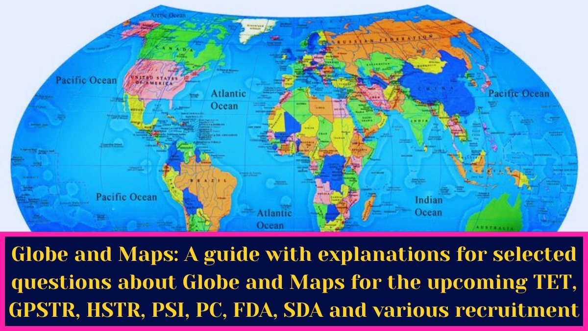
Globe and Maps:A guide with explanations for selected questions about Globe and Maps for the upcoming TET, GPSTR, HSTR, PSI, PC, FDA, SDA and various recruitment exams.

1. Which among the following state. ments is true regarding International Date line?
1) It is 180° Longitude
2) It is a straight line
3) It is a big circle
4) It is a curved line beyond earth
Ans:- 1) It is 180° Longitude
• International Date Line (IDL): A line drawn in a zigzag pattern across the Pacific Ocean at 180° longitude. It helps in marking the difference in date and time between east and west of 180°.
• Greenwich Mean Time (GMT): 0° longitude is the prime meridian (passing through Greenwich, London) in the UK.
• Indian Standard Time (I.S.T): 8240 East longitude (5½ hours ahead of GMT) Indian Standard Time. (Passes over Prayagraj (Mirzapur) in Uttar Pradesh).
• The 180′ longitude International Date Line was decided at the International Meridian Conference held in Washington, D.C. in 1884. It is considered a boundary line. It is drawn in a zigzag manner in the Pacific Ocean without affecting the politics and borders of countries.
——————————————————————————
2. The Tropic of Cancer does not pass through
1) Myanmar
2) Nepal
3) Bangladesh
4) China
Ans:- 2) Nepal
• Tropic of Cancer:- Passes through Australia, Niger, Libya, Egypt, Saudi Arabia, United Arab Emirates, Oman, India, Bangladesh, Myanmar, China, Mexico, Bahamas, Mauritania, Mali, etc.
• Equator (0 latitude):- Passes through 13 countries. Ecuador,
• Colombia, Brazil, Sao Tome and Principe, Gabon, Congo, Republic of, Democratic Republic of the Congo, Uganda, Kenya, Somalia, Mali, Indonesia, and Kiribati
—————————————————————————-
3. Which one of the following rivers crosses the tropic of capricorn twice?
1) Vaal
2) Limpopo
3) Nizer
4) Zambezi
Ans:- 2) Limpopo
• The Limpopo River crosses the Tropic of Capricorn twice.
• It originates in the Transvaal, flows through South Africa, Botswana, and Mozambique, and empties into the Indian Ocean.
• It is the second largest river in Africa that flows into the Indian Ocean, after the Zambezi River.
——————————————————————————
4. The Equator does not pass through which of the following countries?
1) Kenya
2) Mexico
3) Indonesia
4) Brazil
Ans:- 2) Mexico
• The equator passes through 13 countries: Ecuador, Colombia, Brazil, São Tomé & Príncipe, Gabon, Republic of the Congo, Democratic Republic of the Congo, Uganda, Kenya, Somalia, Mali, Indonesia,
—————————————————————————-
5. The disconnected lines drawn on a map for showing slope
1) Bench marks
2) Contours
3) Form lines
4) Hachure
Ans:- 4) Hachure
• Hachures are small disconnected lines drawn on a map to depict the slope of the ground surface. They are drawn in rows; each row is disconnected from the next. They are closely spaced for steep slopes. They are relatively short and long and widely spaced for gentle slopes.
• Hatcheries cannot be drawn on flat areas, such as a flat valley or the top of a plateau.
—————————————————————————
6. Magnetic Meridian is a
1) Line parallel to the equator of the Earth
2) Latitude
3) Line joining the geographic north and geographic south of Earth
4) Plane passing through the magnetic north and magnetic south of Earth
Ans:- 4) Plane passing through the magnetic north and magnetic south of Earth
• The magnetic meridian approximates a line on the Earth’s surface.
• The great circle passing through the north and south magnetic poles can be taken as the horizontal unit of the magnetic field lines along the Earth. The compass needle is parallel to the magnetic meridian.
——————————————————————————
7. What are the imaginary lines encircling the earth horizontally called?
1) Latitudes
2) Longitudes
3) Isobars
4) Isotherms
Ans:- 1) Latitudes
• Imaginary lines drawn parallel to the equator running from east to west (horizontally) on the surface of the Earth are called latitudes.
• Latitude is a circle that extends from the equator to 90° (north or south) at the poles. It is used with longitude to specify the precise location of features on the Earth’s surface.
—————————————————————————-
8. Which of the following pair is CORRECT?
1) 23 1/2° South-Tropic of Cancer
2) 23 1/2°South-Tropic of Capricorn
3) 23 1/2° North – Tropic of Capricorn
4) 66° North Antarctic Circle
Ans:-3) 23 1/2° North – Tropic of Capricorn
• Capricorn is located 2319 south of the equator.
————————————————————————–
9. The distance of 1º longitude on Earth is almost equal to which of the following?
1) 24 km.
2) 69 km.
3) 111 km.
4) 152 km.
Ans:-3) 111 km.
• At the equator, 10 degrees latitude or longitude represents approximately 111 km (approximately 70 miles).
—————————————————————————-
10. Maps showing natural features of the earth are called_________ maps
1) Relief
2) Political
3) Thematic
4) Symbolic
Ans:- 1) Relief
• The type of map that shows the natural features of the earth is called a natural map or physical map.
• This is a type of map that focuses on the geography of a specific area.
• Shows the landforms of a particular area, such as deserts, valleys, plains & mountains.
—————————————————————————–
11. Which of the following pair is INCORRECT?
1) 0° longitude Prime Meridian
2) 0° longitude – Equator
3) 0º latitude Equator
4) 23/½° North – Tropic of Cancer
Ans:- 2) 0° longitude – Equator
• On Earth, the equator is an imaginary line at the top, equidistant from the North and South Poles.
• Dividing the Earth into northern and southern hemispheres.
• The latitude of the Earth’s equator is, by definition, 00 (zero degrees circle.
• The circumference of the Earth’s equatorial circle is 40,076 km and the polar circumference is 40,006 km.
• The equatorial diameter is 12,756 km and the polar diameter is 12,714 km.
—————————————————————————–
12. Which imaginary line, located at zero degree latitude, divides the earth into northern and southern hemispheres?
1) Tropic of Capricorn
2) Tropic of Cancer
3) Equator
4) None of these
Ans:- 3) Equator
• Latitudes: Latitudes are drawn on a sphere with the Earth’s axis as the reference.
• An equatorial circle is drawn perpendicular to the Earth’s orbit between the North and South Poles. The imaginary lines drawn east-west on the globe parallel to this equatorial circle are called ‘latitudes’.
• The equator is a great circle from which the latitudinal circles to the north and south become smaller. That is, 90° north and south latitudes are points.
• The equator creates 90° latitudes in the Northern Hemisphere and 90° latitudes in the Southern Hemisphere.
• The distance on Earth from one latitude to another is 110.4 km.
————————————————————————
13. Where is duration of the day and night on Earth are almost the equal?
1) At the Equator
2) On the Poles
3) On Line of Capricorn
4) On the Arctic Line
Ans:- 1) At the Equator
• There are two ayanas (June 21 and December 22) and two viśavatsam revolutions (September 23 and March 21) in the seasons.
• During the solstices, the sun’s rays fall directly on the Tropic of Cancer and Capricorn, and on the equatorial circle during the equinoxes.
• The ions influence the duration of day and night (in both hemispheres).
• Similarly, on the equinoxes (the solstices), there are equal days and nights (in both hemispheres).
—————————————————————————
14. What are the imaginary line touching both the poles of earth called?
1) Latitudes
2) Longitudes
3) Isobars
4) Isotherms
Ans:- 2) Longitudes
• Lines of longitude: Lines that intersect the equator and meet the North and South Poles are called lines of longitude.
• Longitudes are imaginary lines that meet areas equidistant east and west of the prime meridian (Greenwich Mean Time) and are measured in degrees on the equator.
————————————————————————-
15. For a time difference of two hours, the longitudinal distance will be equal to
1) 15°
2) 30°
3) 45°
4) 60°
Ans:- 2) 30°
• The earth is divided into 360 degrees of imaginary lines of longitude. When these 360° are divided by 24 hours, each line of longitude is 4 minutes or 360° = 24 hours, so 1 hour = 15°, 1 degree = 4 minutes. Therefore, for a time difference of two hours, the distance of longitude is equal to 30°.
—————————————————————————
16. The distance between the two latitudes is approximately
1) 111 miles
2) 121 miles
3) 111 km
4) 121 km
Ans:- 3) 111 km
• The equator creates latitudes of 90′ in the northern hemisphere and 90° in the southern hemisphere. The distance on Earth from one latitude to another is 110.4 km.
• The distance between two lines of longitude gradually decreases as one moves from the equator towards the poles. This is because all lines of longitude meet at both poles.
• The distance between two lines of longitude is greatest at the equator, about 111 km.
——————————————————————————
17. A sector between the two longitude lines is known by which of the following name?
1) Belt
2) Gore
3) Time-block
4) Time box
Ans:- 2) Gore
• The distance between two lines of longitude is called a girder.
• A gore is a curved line on a sphere between two parallel lines of longitude. It refers to the curved • upper zone.
—————————————————————————–
18. Convectional Rainfall occurs in:
1) Equatorial region
2) Temperate region
3) Tropical region
4) Polar region
Ans:- 1) Equatorial region
• Convectional rainfall:
• Rain that occurs when air rises upward in the form of convection currents is called atmospheric rain.
• In areas where the temperature is high, the air heats up and moves upward, then reaches a sufficient height and cools, and the water content in it condenses into droplets, resulting in precipitation. This is atmospheric precipitation,
• This type of rain is common in the equatorial region and tropical regions during the summer. This rain is often accompanied by thunderstorms.
——————————————————————————
19. Subtropical high pressure belts are otherwise called
1) Furious fifties
2) Screeching sixties
3) Horse latitudes
4) Roaring forties
Ans:- 3) Horse latitudes
• Subtropical high pressure belt This zone is found between 25° and 35° north and south latitudes.
• The daily motion of the Earth and the upward-moving air descending in the form of convection currents create high pressure. This is where the trade and anti-trade winds originate. This zone is called the “horse latitudes”.
• There are two subtropical high pressure belts in the globe.
1) Northern subtropical high pressure belt
2) Southern subtropical high pressure belt
——————————————————————————-
20. What is the full form of ITCZ?
1) Inter tropical converter zone
2) Inter tropical convergence zone
3) Inter tropical centre zone
4) None of these
Ans:-2) Inter tropical convergence zone
• Intertropical Convergence Zone (ITCZ): The wind speed is very low in this zone. It is in this zone that the trade winds of both the hemispheres meet. It is called the Intertropical Convergence Zone. It is usually called the “Equatorial Trough”.
——————————————————————————
21. Contours are imaginary lines showing
1) places of equal atmospheric pressure
2) same temperature areas
3) places of equal altitudes
4) equal sunshine areas
Ans:- 3) places of equal altitudes
• A contour line is a curved line that joins points of equal height or low point.
• In cartography, contours join points of equal elevation above a given standard level, such as mean sea level.
• This is a map that describes the topographic features of an area.
• It is often used to show the height, slope, and depth of valleys and hills.
• The distance between two consecutive contour lines on a contour map is called the contour interval, which shows the difference in elevation.
——————————————————————————
22. Maps on large scale, representing both natural and man-made features are called
1) Wall maps
2) Topographic maps
3) Thematic maps
4) Atlas maps
Ans:- 2) Topographic maps
• A topographic map is a type of map characterized by a large scale of detail and a quantitative representation of relief.
• Wall maps are larger than atlases. They are used as teaching aids in classrooms. They show general and important features such as political divisions, elevations, etc.
• Although atlas maps are small, they provide us with detailed information.
• Thematic maps are thematic maps that focus on specific topics or phenomena, such as population density, rainfall and precipitation levels, vegetation distribution, and poverty. This is different from reference maps, which cover many different aspects, such as roads, topography, and political boundaries.
• Cadastral Maps:- A cadastral map is a map that provides detailed information about real property within a given area. A simple example of a cadastral map might be a village map, which shows the boundaries of the properties within the village.
—————————————————————————–
23. A person, who draws or makes maps or charts, is called.__________
1) Hydrographer
2) Cartographer
3) Seismographer
4) Cartogrammer
Ans:- 2) Cartographer
• A cartographer is a person who draws or makes maps. He is involved in developing maps with scientific, technical and artistic aspects.
• Cartography is the art and science of graphically representing a geographic area.
• A map is a drawing (picture) of the whole or part of the Earth on a plane, drawn to scale.
• The science and art of making maps is called ‘Topography’.
————————————————————————